
State Route 60 East Corridor Study Public Meetings
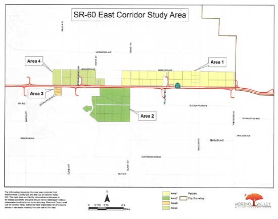
The SR60 East Corridor Study will identify land use alternatives for four sub- areas along the freeway with consideration of highest and best land use. The study area traverses along the eastern portion of Highway 60, from roughly Nason Street to the City limits from west to east and Hemlock Avenue to Eucalyptus Avenue from north to south. Please see attached map for specific location details.
The City of Moreno Valley, with assistance from the City’s Consultant Raimi and Associates, has prepared a preferred concept and two additional alternative land use concepts for public review available with the Planning Commission staff report. The information provided focuses on long-term goals and policy guidance for any future land use modification proposals within the study area. A Community Workshop on October 14, 2013 provided the opportunity to review land use alternatives with stakeholders, property owners, and residents. The input received at the Community Workshop has facilitated the development of the land use study. Three alternatives were presented at the Community Workshop. Based on considerable public input, the consultant along with staff developed the preferred alternative. The preferred alternative is similar to Alternative 1 presented at the meeting.
Two additional public meetings have been conducted or are scheduled to be conducted at Planning Commission and City Council meetings. On November 14, 2014, the Planning Commission conducted a public meeting to review the Study. On January 14, 2014 (rescheduled from December 10, 2013), at 6:00 p.m. in Council Chambers, the City Council will conduct a public meeting on the Study.
Please see a copy of the Highway 60 East Corridor area map below.
For more information on this project, please contact Mark Gross, Senior Planner at (951) 413-3215 or the Moreno Valley Planning Division at (951) 413-3206.